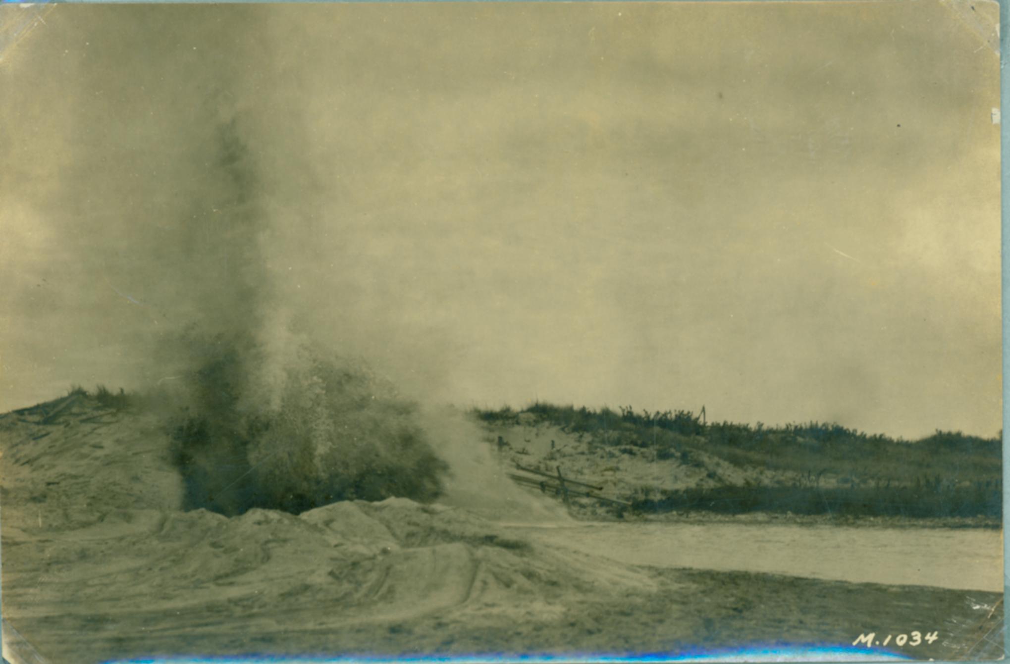
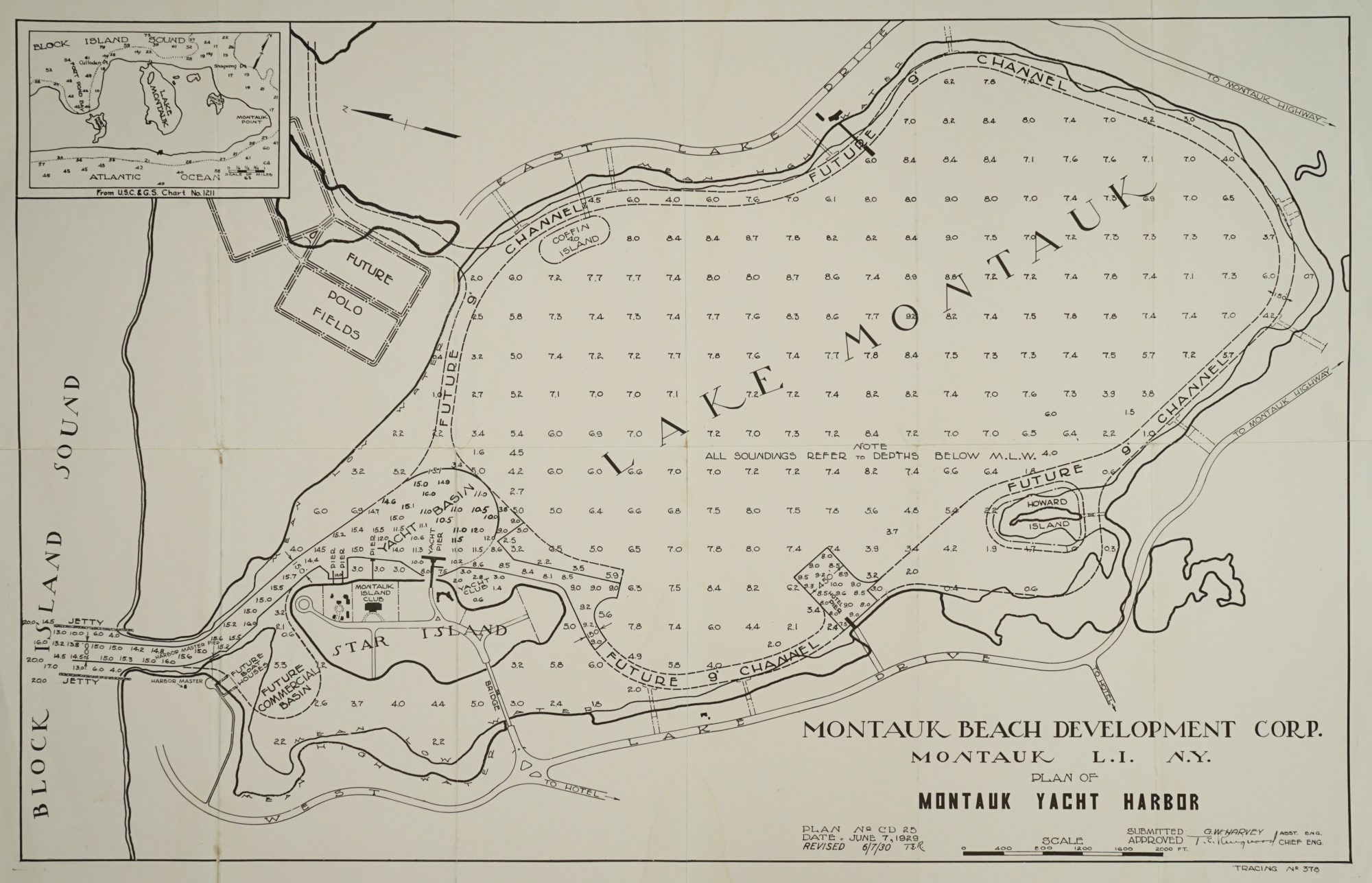
“A great force of engineers and surveyors is now engaged at Montauk,” the County Review reported in November of 1925. “They have dug a channel from Great Pond to Block Island Sound, and the pond was drained last week. In two hours it fell 11 inches.”
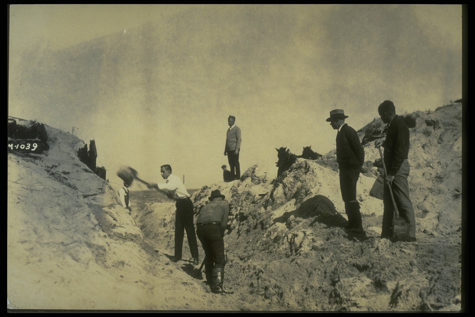
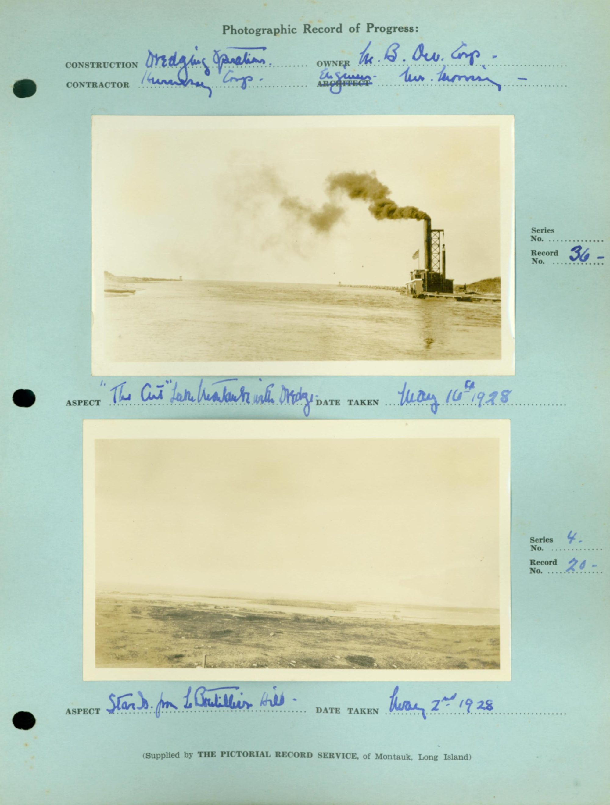
Known today as Montauk Inlet, that channel was the same one dredged last week by the Army Corps of Engineers – the channel that Carl Fisher created as part of his vision to develop Montauk into a Miami Beach of the North. Fisher’s men blasted and dug their way in and around the former Great Pond, or Lake Wyandanch, one of the largest freshwater lakes on Long Island, to create an artificial bay. It went on to become the home of the largest commercial and sportfishing fleets in New York State.
“Last fall a ditch through the beach, connecting that with Block Island Sound, was cut by the Fisher workmen, but an easterly storm has closed it,” the County Review reported in March of 1926. The plan is to eventually dredge a deep canal there, protecting it with jetties, permitting yachts to use Great Pond as a safe harbor.”
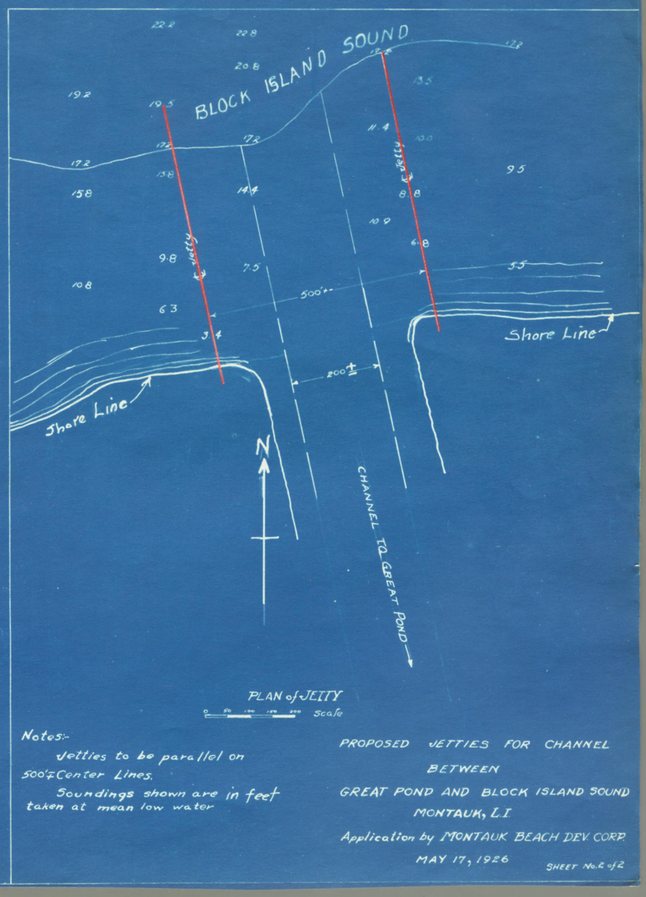
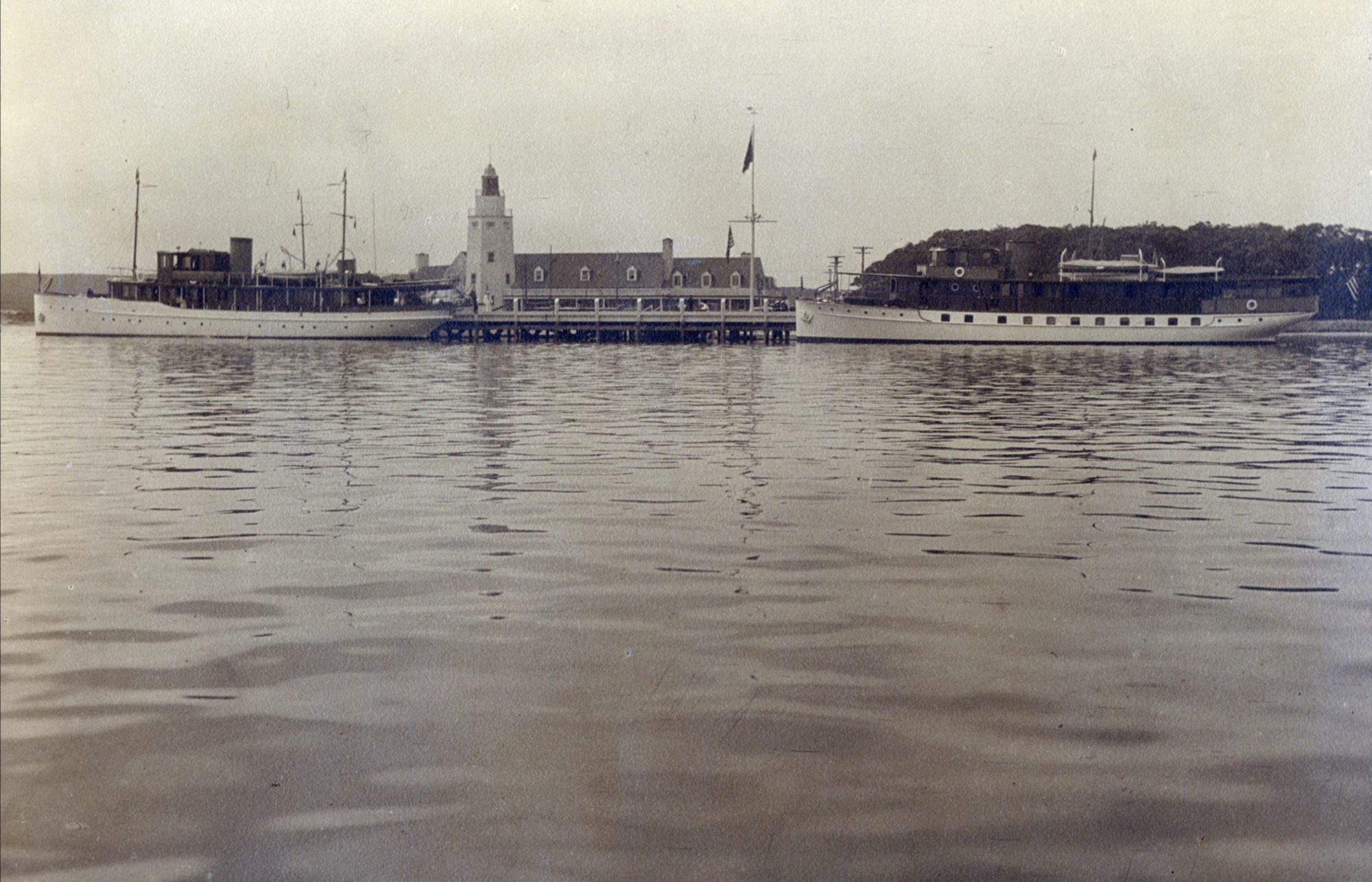
Indeed, by the late 1920s, Lake Montauk was the site of motorboat races and gambling casinos at island clubs connected by a bridge to Montauk’s mainland. In addition, a pair of jetties had been erected.
Quoting an extremely brief entry in the records of the East Hampton Trustees, The County Review noted that there had been at least one precedent for Fisher’s grand scheme to connect to the sound:
“Harry D. Sleight, a historian, notes that in 1684 it was ‘voted at Town Meeting that 16 men be appointed to help the Indians open the Great Pond at the north end.’”
The entry did not explain what either party was hoping to achieve by doing this. In the 1970s, however, Everett T. Rattray wrote in The South Fork: The Land and the People of Eastern Long Island, of Great Pond:
“It was brackish and only occasionally open to salt water, sometimes deliberately. My grandfather and his fellow fishermen would dig a shallow trench along the beach and rig nets across the rapidly widening outflow to catch wagonloads of fish, including, they remembered, eels as thick as your arm.”
One Comment
Fascinating entry. Our talented writer deftly connects current dredging efforts at the Montauk Inlet, with that first trench dug in the 1920s. The 1684 reference to local proprietors voting to help Montaukett Indians ‘let’ the pond in 1684 shows the sweep of history as locals used and developed their environment over centuries.
So much said in this short submission. Thanks for that. Are Throwback Thursday entries being collected and made available in a digital file. I see a book here.